


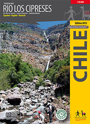
Trekking Map Rio Los Cipreses 1:100 000/1:25 000 (2014)
- Normale prijs
- €14,90
- Verkoopprijs
- €14,90
- Normale prijs
niet voorradig
- Eenheid prijs
Levertijd is 1-3
| ISBN-EAN | 9789568925260 |
| Uitgever | Trekkingchile.com |
| Jaar van uitgave | 2014 |
| Bindwijze | Paperback |
| Taal | Spaans-Engels-Duits |
| Levertijd | 1-3 |
| Soort | Wandelkaarten |
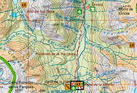
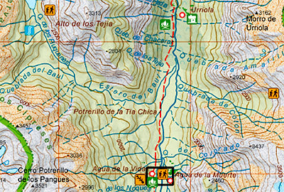
1st edition, feb. 2014: Hiking map of the National Preserve Rio Los Cipreses east of Rancagua, developed by the Institute for Cartography at the Dresden Technical University. Overview map1:100,000 showing the whole preserve with the Laguna Piuquenes and several 4,000 meter summits, being El Palomo volcano the highest with 4860 m. Detail map 1:25,000 of the preserve’s entrance area. GPS compatible, with hiking routes, level curves every 50 m, mountain huts, lodgings and campsites. Landscape pictures and drawings of the local fauna. English - German - Spanish.