
Green Map Rotterdam with surroundings
- Regular Price
- €5,95
- Sale Price
- €5,95
- Regular Price
- Unit Price
- per
Deliver in 1-3 days
| ISBN-EAN | GR KRT RDAM |
| Uitgever | Rotterdam Environmental Center |
| Jaar van uitgave | 2001 |
| Formaat | 24.5x23cm folded |
| Taal | Dutch |
| Levertijd | 1-3 days |
| Soort | Miscellaneous |
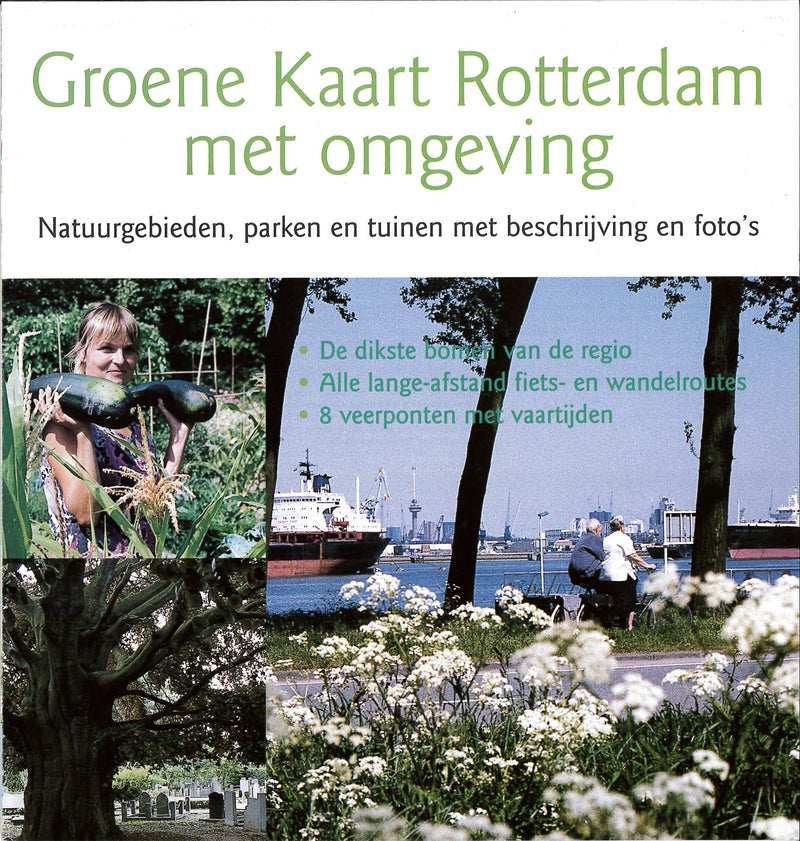
The Green Map of the Rotterdam region is a detailed map (1:20,000) of Rotterdam and the surrounding area with all green elements.
The map was published by the Rotterdam Environmental Center at the end of 2001.
>>>
The map measures 100 by 140 cm and shows the area between Delft and Nieuwerkerk, Ridderkerk and Spijkenisse in detail. The back of the map contains descriptions of 125 nature reserves, parks, gardens and cemeteries with many photos and images. There are also 37 special trees indicated and described on the map. Including the thickest trees in the region.
The text on the back is illustrated with 85 color photos and about ten drawings of trees and plants.
The map was created in collaboration with the Rotterdam Urban Nature Bureau (bSR), the VNMN and the World Wildlife Fund. A large number of nature, environmental, residents' organizations and (sub)municipalities cooperated. The Postcode Lottery, the World Wildlife Fund, the municipality of Rotterdam and 'Rotterdam Cultural Capital 2001' funded the project.
The map was published at the end of 2001 but is still very current to this day.