


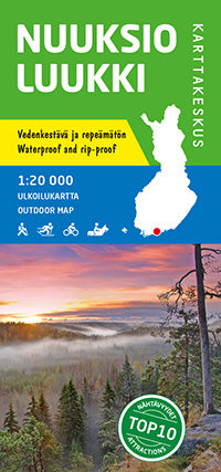
Outdoor Map Nuuksio Luukki 1:20.000 (2016)
- Normale prijs
- €19,90
- Verkoopprijs
- €19,90
- Normale prijs
- Eenheid prijs
Levertijd is 1-5 dagen
| ISBN-EAN | 9789522664679 |
| Uitgever | Karttakeskus |
| Jaar van uitgave | 2016 |
| Formaat | 21,5x10cm (uitgevouwen: 110x85cm) |
| Bindwijze | Paperback |
| Taal | Fins-Zweeds-Engels-Duits-Russisch |
| Levertijd | 1-5 dagen |
| Soort | Wandelkaarten |
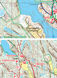
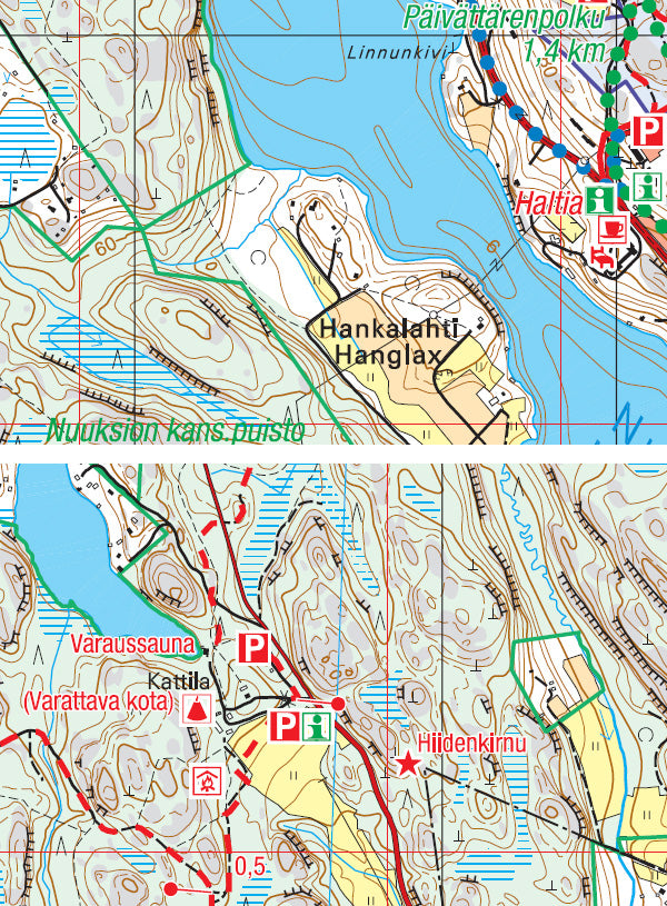
The outdoor map of Nuuksio and Luukki covers Nuuksio national park and other outdoor recreation areas in the Nuuksio Lake Uplands. The scale of the single-sided map is 1:20,000 (1 cm on the map = 200 m on the ground).
The map shows all of the popular Nuuksio National Park. Also the outdoor recreation areas of Karjakaivo, Luukki, Pirttimäki, Salmi, Vaakkoi and Kauhala, managed by the city of Helsinki, are included together with their surrounding areas. In addition, the outdoor recreation areas of Oittaa and Kattilajärvi, managed by the city of Espoo, are shown. The trails marked on the map include the Trail 2000, the nature trails of Nuuksio Nature Park, the riding trails of northern Espoo and the cross-country ski trail network of the area.
The map is based on a topographic map and has plenty of extra information for hikers and travellers, such as various trails and their lengths, cooking shelters, campfire sites, lean-to shelters, swimming spots and parking areas.
The map can be used with a GPS device, and it has details on magnetic declination and coordinate system (YKJ, the Uniform Coordinate System) printed on the side. The map has also the ETRS-TM35FIN coordinate system.