


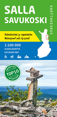
Outdoor Map Salla Savukoski 1:100.000 (2016)
- Normale prijs
- €21,90
- Verkoopprijs
- €21,90
- Normale prijs
- Eenheid prijs
Levertijd is 1-5 dagen
| ISBN-EAN | 9789522664570 |
| Uitgever | Karttakeskus |
| Jaar van uitgave | 2016 |
| Formaat | Uitgevouwen: 121 × 82 cm |
| Bindwijze | Paperback |
| Taal | Fins-Zweeds-Engels-Duits-Russisch |
| Levertijd | 1-5 dagen |
| Soort | Wandelkaarten |
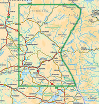
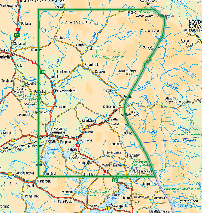
The outdoor map of Salla and Savukoski map shows eastern Lapland from the Lokka Reservoir in the north to the southern border of Salla municipality in the south. In the east the map stretches to the Russian border and in the west to the municipalities of Pelkosenniemi and Kemijärvi. The scale of the map is 1:100,000 (1 cm on the map = 1 km on the ground).
Printed on a single waterproof and rip-proof sheet, the double-sided outdoor map covers a large area including the resorts of Suomutunturi, Sallatunturi and Pyhätunturi as well as the Tuntsa Wilderness Area. The map can be used for hiking and cross-country skiing. Also snowmobile routes and Lake Kemijärvi water routes are included.
The map is based on a topographic map of the National Land Survey of Finland and has plenty of extra information for hikers and travellers, such as various trails and their lengths, wilderness huts, lean-to shelters, eating places, accommodations and sights.
On the side of the map you will find coordinates for all the wilderness huts managed by Metsähallitus to help locate them with a GPS device. Details on magnetic declination and the coordinate system (YKJ, the Uniform Coordinate System) are also found on the map together with information on trekking and nature in the areas of Sallatunturi and Tuntsa.