


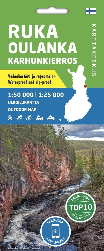
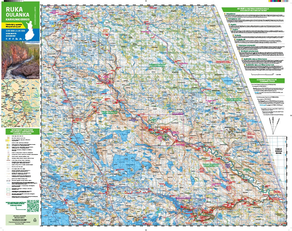
Outdoor Map Ruka Oulanka Karhunkierros 1:50.000 | 1:25.000
- Normale prijs
- €21,95
- Verkoopprijs
- €21,95
- Normale prijs
- Eenheid prijs
Levertijd is 1-7 dagen
| ISBN-EAN | 9789522666741 |
| Uitgever | Karttakeskus |
| Jaar van uitgave | 2020 |
| Land | Finland |
| Formaat | 80 x 60cm |
| Taal | Fins-Zweeds-Engels-Duits-Russisch |
| Levertijd | 1-7 dagen |
| Schaal | 1:50.000 | 1:25.000 |
| Soort | Wandelkaarten |
De outdoorkaart Ruka Oulanka Karhunkierros 1:50 000 / 1:25 000 is gedrukt op synthetisch materiaal.
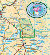
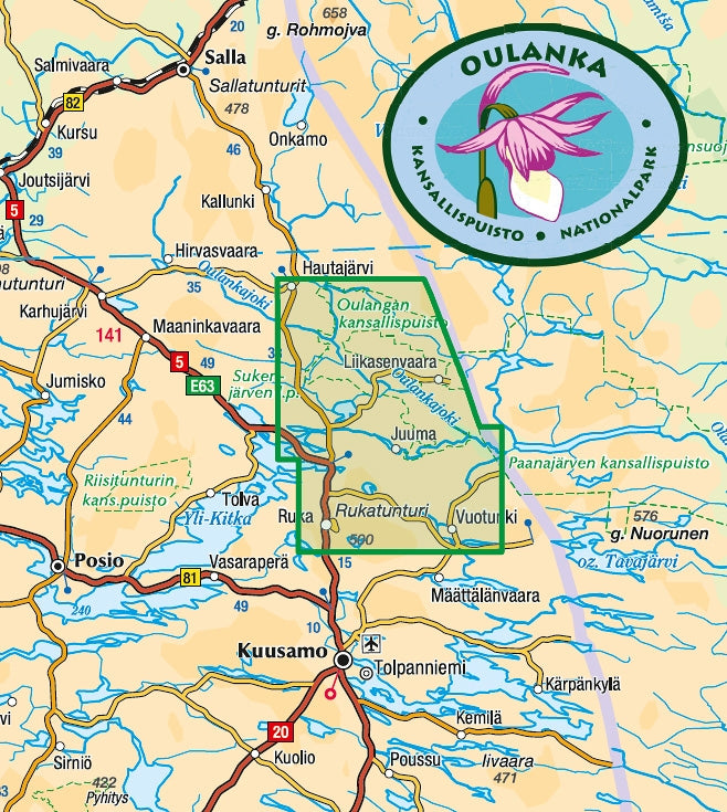
De dubbelzijdige kaart bestrijkt de mooiste trekkinggebieden van Kuusamo. Opgenomen zijn de populaire Karhunkierros (Berenpad) wandelroute, Oulanka Nationaal Park, de wandelpaden en langlaufloipes in de omgeving van Ruka Resort en de uitnodigende visplekken van de rivier Kuusinkijoki. De regio is populair bij langlaufers, wandelaars, vissers en sneeuwscooters.
Het materiaal van de kaart is volledig waterproof en bestand tegen bijna eindeloos vouwen, en het zal niet scheuren bij normaal kaartgebruik. Ook bij vorst en hitte blijven de kenmerken behouden. De kaart voelt prettig aan en is lichter dan wanneer hij op papier zou zijn gedrukt.
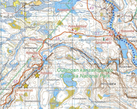
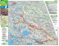
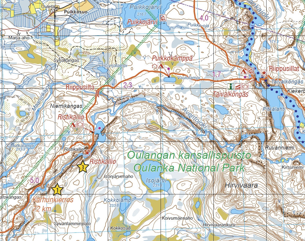
Naast terreingegevens zijn bijvoorbeeld hutten, routes en andere wandeldiensten, evenals eet- en overnachtingsmogelijkheden, op de kaart aangegeven. De kaart bevat tien attracties of belevenissen in het gebied, die in een paar zinnen aan de rand van de kaart in het Fins en Engels zijn beschreven. Aan de rand van de kaart vindt u ook alle coördinaten van de hutten in het gebied, evenals informatie over de magnetische declinatie. De schaal van de kaart is het best geschikt voor Fins terrein 1:50 000 (1 cm op de kaart = 500 m terrein). De populairste dagwandelingen zijn ook beschreven in een meer gedetailleerde schaal van 1:25 000.
The outdoor map Ruka Oulanka (Bear Trail) covers the most beautiful trekking areas of Kuusamo. Included are the popular Karhunkierros Hiking Trail, Oulanka National Park, the hiking trails and cross-country ski trails in the vicinity of Ruka Resort and the inviting fishing spots of the River Kuusinkijoki. The region is popular among cross-country skiers, hikers, fishers and snowmobilers.
In addition to detailed information on the terrain, the map shows e.g. the wilderness huts, hiking trails, snowmobile routes, eating places, accommodations and sights. Also paddling and white-water routes are shown. The Karhunkierros Trail and the Pieni Karhunkierros Trail are in their own colours to separate them clearly from the other trails. There is a larger version of the Pieni Karhunkierros Trail on the side of the map as well as a map of the Ruka Resort with road names, travelling information and details on services provided in the resort. The map has the WGS 84 coordinates of all the wilderness huts in the area and magnetic declination information.
The map can be used with three coordinate systems (metric ETRS-TM35FIN, geographic grid EUREF-FIN and the metric YKJ Uniform Coordinate System) and with a GPS device. The scale of the map is 1:50,000 (1 cm on the map = 500 m on the ground), and it is double-sided.